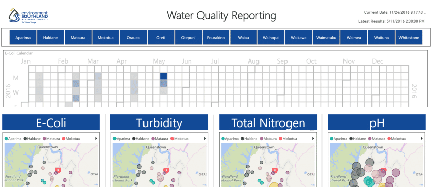
The BI team provides a fully functional Water Quality data visualisation with PowerBI
A fully functional water quality proof of concept demonstrates the capability of PowerBI and the WalkerScott team.
Keen to understand the capabilities of online data visualisation tools, Environment Southland published a ‘Proof of Concept’ request based on a user story:
“As an Environment Southland Scientist I want to see the correlation between the results of different water quality sampling sites within a catchment over time so that I can understand the areas of the catchment that are contributing the most to the deterioration of water quality.”
The PoC uses PowerBI’s built in ETL feature to extract data direct from Web/API’s with no dependency on an intermediate data mart or data warehouse and includes Geo mapping integration to deliver additional insights. The model:
- Establishes correlation between quality and catchments/sites with couple of clicks,
- Provides data sensitive narratives for automated commentary on the insights,
- Leverages investments/competencies in R for advanced analytics.
The data set provided by Environment Southland was augmented by river flow data from the ‘HillTop’ website which demonstrates the ease of data collation and presentation.

